


Modern Nautical Charts for the Lower North Shore
The Canadian Hydrographic Service (CHS) has begun modernizing nautical charts covering the Lower North Shore by adjusting them. They will replace the current ones as they are published.
The current charts for this region cannot be used on ECDIS navigation systems, since they are based on geographic reference maps that are not suitable for GPSs. In addition, the depths indicated on these maps were obtained with old techniques that are no longer used. To meet new standards, the CHS performed multibeam surveys of harbour and wharf channels and approaches, in addition to using LiDAR technology.
Unlike echosounders, which bounce sound waves off the sea floor, bathymetric LiDAR uses two laser beams, one reflected from the water surface, and the other from the sea floor. Given that these are optical techniques, the depth measured is affected by certain water characteristics, including transparency. This system is brought on board an aircraft, making it possible to cover very large surfaces in a short amount of time. The system also has the benefit of surveying land elevations, thus combining topographic and bathymetric data. The new specific and detailed data acquired made it possible to discover shoals and better chart the shoreline. This sophisticated technology will help create modern electronic navigational charts and even meet the new standards of the International Hydrographic Organization.
The first two charts in the series—produced at a scale of 1:40,000—were released in February. They are now available from authorized CHS chart dealers, under numbers 4970 Baie de Bonne-Espérance à/to Île Mistanoque and 4971 Blanc Sablon à/to Baie de Bonne-Espérance. They also contain insets covering, in greater detail, certain harbours such as Blanc-Sablon, Vieux-Fort, Passe de Champlain, and Baie Chevalier. A Notice to Mariners (www.notmar.gc.ca) was issued to announce their publication, as well as the withdrawal of charts 4470, 4471 and 4980. Mariners and fishers will be able to use new, modern charts available not only in paper format but also in both electronic formats offered by CHS, namely BSB and S-57.
Thanks to the Government of Canada's Ocean Protection Plan, subsequent survey campaigns will make it possible to complete data collection and make new charts. Fisheries and Oceans Canada will therefore offer modern tools to mariners and coastal communities.
Robert Dorais
Science
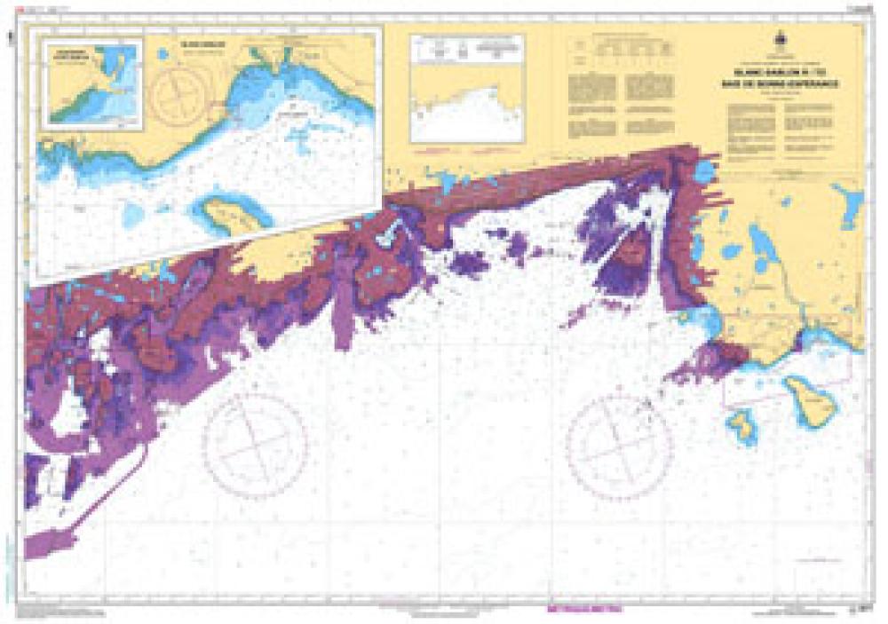
This new chart incorporates recent data acquired using new airborne LiDAR and multi-beam sounding technology. It is the first in a series of new charts that will cover the Lower North Shore and meet modern navigation standards.
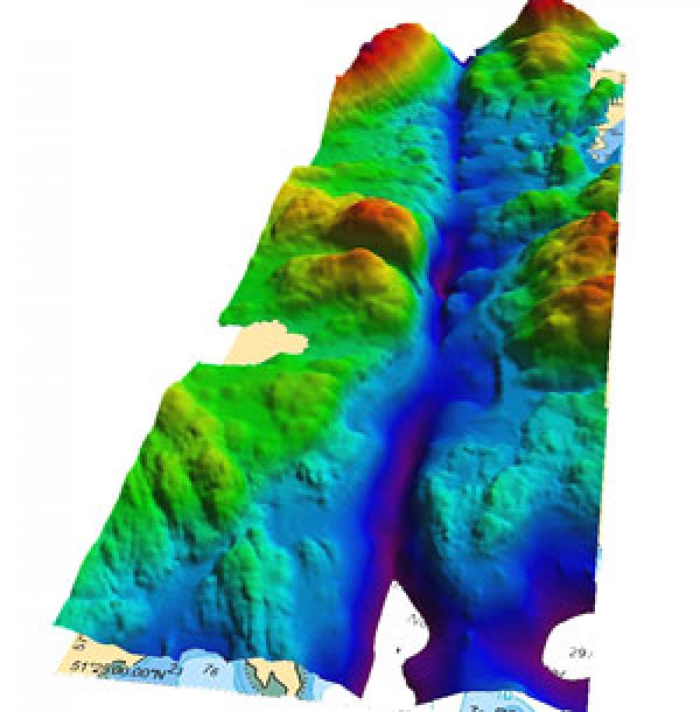
Passe de Champlain, near the village of Rivière-Saint-Paul. This image combines topographic and bathymetric LiDAR data with multi-beam sounding data. This makes it possible to examine the topography and bathymetry from which the depths shown on the nautical chart are drawn.


